CNN Weather Center — Hurricane Erin, the fifth named storm of the 2025 Atlantic hurricane season, has quickly intensified into a major hurricane, forcing urgent warnings for coastal communities from the Caribbean to the southeastern United States. Meteorologists are watching Erin’s track as it gathers strength over warm Atlantic waters, heightening fears of dangerous impacts in the days ahead.
Erin’s Rapid Intensification Sparks Alarm
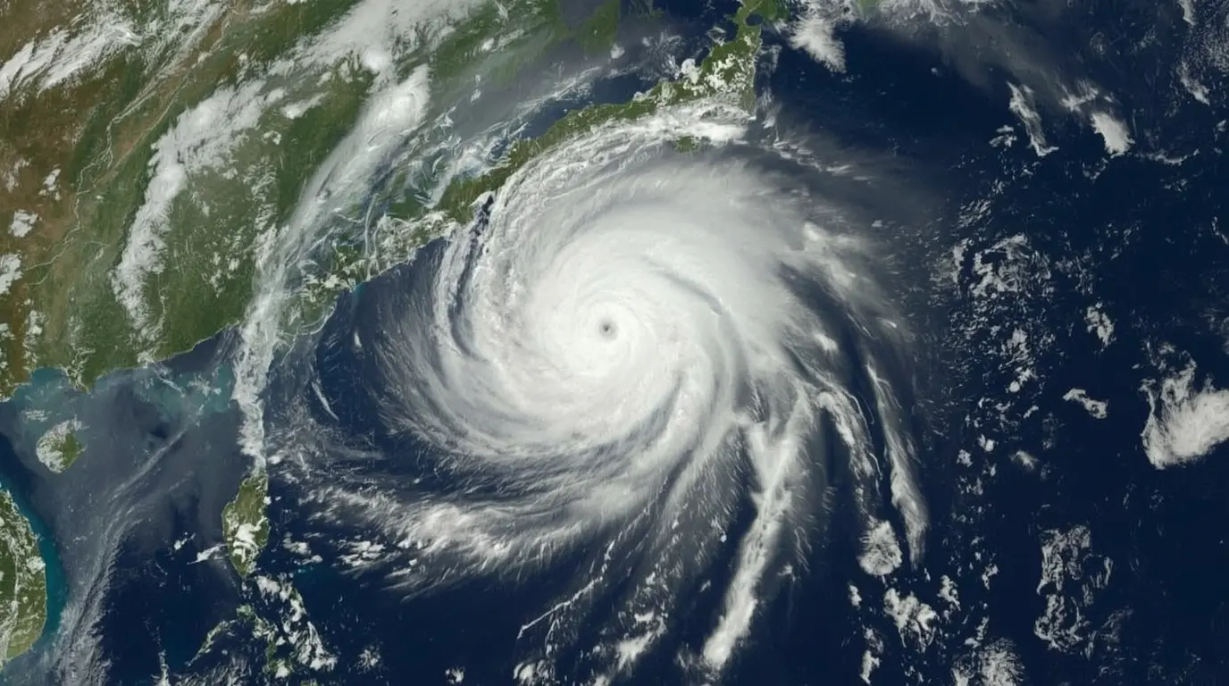
As of Tuesday morning, Hurricane Erin has maximum sustained winds of 120 mph, placing it as a Category 3 storm on the Saffir-Simpson scale. The National Hurricane Center reports Erin is moving northwest at 14 mph, and additional strengthening is likely as it enters more favorable atmospheric conditions.
“Erin has become more organized, showing a tight eye surrounded by powerful rain bands,” said Dr. Michelle Carter, senior hurricane specialist at the NHC. “The warm ocean water and low wind shear are fueling rapid strengthening, and we can’t rule out the chance of it becoming a Category 4.”
Possible Hazards: Surge, Rain, and Wind Damage
Hurricane Erin brings several serious dangers—making surge, rain, and wind a threat to life and property. Coastal areas of the Bahamas and Florida’s east coast are under hurricane watches, and evacuations in low-lying zones are already in effect.
Surge: Experts predict surge heights of 6 to 9 feet in some areas, leading to potentially devastating coastal flooding.
Rainfall: Erin is likely to drop 10 to 15 inches of rain, with some spots possibly hitting 20 inches. This raises the chance of flash flooding and landslides.
Winds: Hurricane winds reach out 40 miles from the center, while tropical-storm winds extend 140 miles.
Florida Governor Ron DeSantis has issued a state of emergency in several counties and is telling residents to get ready for possible evacuations. “Don’t wait until the last minute,” DeSantis warned at a news briefing. “If you live in an evacuation zone, follow local orders and make sure your disaster kit is ready to go.”
Climate Change and Hurricane Intensity
Researchers have said for years that climate change is behind the stronger and faster hurricanes, like Erin, that we are seeing now. Warmer sea surfaces give storms more energy, and higher sea levels make storm surges more dangerous.
“What we are seeing with Erin matches what climate data has been showing,” said Dr. James Reynolds, a hurricane scientist at the University of Miami. “The Atlantic Ocean is warmer than normal this season, and that gives storms the perfect conditions to grow stronger in a hurry.”
Preparations Underway Along the Coast
Emergency teams are rushing to get ready, bringing in sandbags, bottled water, and backup generators along the coast. Airports in South Florida have put out travel advisories, and cruise lines are changing routes to stay clear of the storm.
In the Bahamas, people are worried about the chance of serious harm, especially because many islands are still bouncing back from earlier storms. Prime Minister Philip Davis said, “We are working with local agencies to ensure shelters are ready and supplies are in place.”
What’s Next for Hurricane Erin?
Forecasts now show Erin could reach Florida’s coast late Thursday or early Friday. Meteorologists warn, however, that even a slight change in the storm’s path could change where the strongest winds hit. Residents as far north as the Carolinas should keep checking the latest news.
“Everyone from Central Florida to the Carolinas should be paying attention,” said CNN meteorologist Tom Sater. “Even if the center of Erin stays offshore, its outer bands could bring dangerous conditions well inland.”
How to Stay Safe
Officials are telling people in at-risk areas to:
- Evacuate if local leaders give the order.
- Protect homes by boarding windows and locking down loose items.
- Get emergency supplies, including food, water, medicines, and important papers.
- Listen to ongoing reports from the National Hurricane Center and local experts.
Hurricane Erin is still heading across the Atlantic, and the next two days are key to figuring out where the storm will go and how strong it will get. Beach towns and coastal neighborhoods should stay alert, because there isn’t much time left to get ready.
Source: https://edition.cnn.com/2025/08/18/weather/hurricane-erin-impacts-tracking-atlantic-climate-hnk
For more news updates, visit our home page.